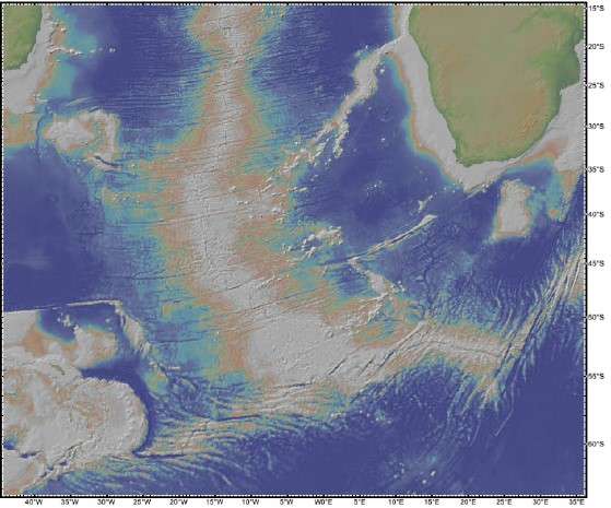
Topographic plate map
The following page has a topographic map of the South Atlantic and neighbouring land-
masses. Either digitally or by hand, draw in the plate boundaries for this map, using colours
or symbols to distinguish between the three different types of plate boundaries (i.e., con-
vergent, divergent, and transform). Add in a simple legend to distinguish the types of plate
boundary. And don’t bother with very short transform boundaries—only show the larger
ones that you can actually reasonably draw without cluttering the map. Finally, label the
four plates that are visible on this map (African, South American, Antarctic, and Scotia,
the latter being a small plate whose eastern boundary is the oceanic trench in the bottom
left of the map). Identify any triple junctions that can be seen on the map and clearly
label them
Please authenticate to join the conversation.
Closed
📸 Photo AI
Over 1 year ago
Subscribe to post
Get notified by email when there are changes.
Closed
📸 Photo AI
Over 1 year ago
Subscribe to post
Get notified by email when there are changes.